
Culpeper ZIP Code Coverage
Culpeper County has 17 standard ZIPs in the research record. Only 22701 is identified with the Town of Culpeper postal city in the official USPS source located. The remaining ZIPs describe postal communities or county-edge coverage, not extra ZIPs inside the incorporated Town. A postal label is an address-delivery tool. It does not define the town boundary, a parcel's legal description, a voting precinct, or a county tax jurisdiction.
| ZIP | County area represented | Post office or postal city | Local reading |
|---|---|---|---|
| 22701 | Town of Culpeper postal city and surrounding rural addresses | Culpeper Post Office | Primary Town ZIP; larger than town limits |
| 20106 | Amissville area | Amissville | County coverage, not Town of Culpeper |
| 22407 | Fredericksburg-area county edge | Fredericksburg | Verify jurisdiction |
| 22713 | Boston | Boston | County postal community |
| 22714 | Brandy Station | Brandy Station | County postal community |
| 22718 | Elkwood | Elkwood | County postal community |
| 22724 | Jeffersonton | Jeffersonton | County postal community |
| 22726 | Lignum | Lignum | County postal community |
| 22729 | Mitchells | Mitchells | County postal community |
| 22733 | Rapidan | Rapidan | County postal community |
| 22734 | Remington | Remington | County postal community |
| 22735 | Reva | Reva | County postal community |
| 22736 | Richardsville | Richardsville | County postal community |
| 22737 | Rixeyville | Rixeyville | County postal community |
| 22740 | Sperryville county-edge area | Sperryville | Verify county line |
| 22741 | Stevensburg | Stevensburg | County postal community |
| 22746 | Viewtown | Viewtown | County postal community |
No verified USPS result located a Culpeper PO-box-only ZIP or a ZIP assigned to one institution. Do not add either category without a current USPS check or confirmation from the local post office.
Culpeper's 22701 Postal Reach
For street delivery, 22701 is the primary ZIP associated with the Town of Culpeper. It also reaches rural places that use Culpeper as the preferred mailing city. County material includes 22701 addresses on rural roads, which is the key local warning: a match to 22701 cannot establish that an address is inside the Town. Confirm the municipal status with Town GIS, and confirm parcel and tax jurisdiction with County WebGIS or the assessment record.
The USPS Culpeper Post Office listing identifies the office at 205 S. Main Street, Culpeper, VA 22701-9998, phone (540) 829-8435. Its listed retail hours are Monday through Friday, 9 a.m. to 5 p.m., and Saturday, 9 a.m. to noon. Services can vary, so the listing is the right place to recheck an office question.
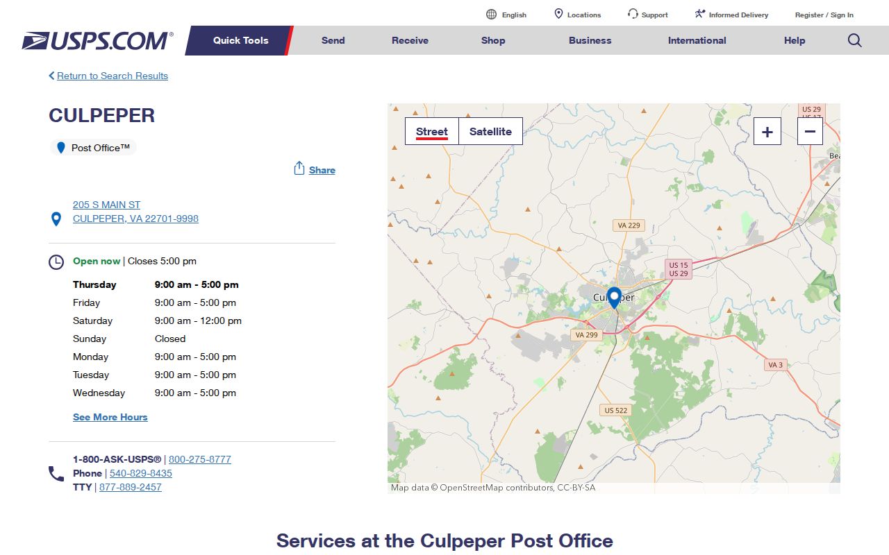
The office record confirms the local postal contact and 22701 service point, while an address-specific USPS lookup remains the better test for an individual mailing address.
Culpeper Records by Postal Community
Brandy Station, Elkwood, Rapidan, Stevensburg, Rixeyville, Reva, Lignum, and other county communities can appear as postal names even though the County holds the parcel, assessment, and many public records. Town and country geography therefore overlap in a way that a one-line mailing label cannot explain. The Culpeper County seat and town core are only one part of the wider county address system.
This matters when comparing a family source with a present address. A newspaper, cemetery note, rural route, town record, county tax map, or postal community may use a different place name for the same general area. Preserve the record's own locality wording, then check the parcel and historic date before translating it into a modern map label. The table above is county coverage, not a roster of town neighborhoods.
The county counted 52,552 people in the 2020 Census and has a 2025 estimate of 57,666, a 9.7 percent rise from the estimate base used in the research. Growth can place a current address in a newer subdivision or at a rural edge that has no match in older town material. The historic downtown centers on Main and Davis Streets, while the county postal pattern includes communities well beyond that core. A current postal result therefore needs a date and a parcel check before it is used to interpret older Culpeper records.
Finding Residents in a Culpeper ZIP
A Culpeper ZIP code directory should be used as an address workflow, not as a promised ZIP-wide resident list. The official public descriptions for Vision eAssessor and County WebGIS document address, owner, tax-map, and map searches. They do not document a public bulk ZIP filter. The Virginia voter Citizen Portal uses a registered residence to assign a precinct, but it does not advertise a public ZIP-filtered voter roll. Start with a real address and preserve the source that confirms each step.
- Use the USPS ZIP Code Lookup to verify the individual mailing address and its postal treatment.
- Check Town GIS if municipal limits are the question, rather than inferring them from the preferred city.
- Search County WebGIS by address, owner, or tax-map number to identify the parcel and its mapped county context.
- Use Vision eAssessor by address, owner name, tax-map or map route to compare the parcel record with the postal address.
- Use the voter portal only for the individual's own registration and precinct, or contact the General Registrar about lawful access routes.
Once a verified postal area is narrowed to a particular street, the Culpeper street directory explains the address-based parcel and deed chain. Do not convert a group of similar mailing labels into a claim that the owners, voters, or other people associated with them are a complete resident group.
Culpeper ZIP Code Search Limits
The research did not document a ZIP-wide public eAssessor filter, WebGIS bulk export, or voter-list filter for Culpeper. That missing documentation is a limit, not an invitation to state that the tools can run such a search. If the live assessor form later presents a ZIP field, record the exact field name, options, result count, and date of observation. Until then, select and verify individual parcels by address, street, owner, tax map, or map view.
| USPS individual lookup | Use an individual mailing address to verify postal treatment. The captured research did not preserve a query-result screen. |
|---|---|
| Vision eAssessor | Address, owner name, tax-map or parcel, and map routes are documented. No public ZIP-wide filter was documented. |
| County WebGIS | Tax-map number, address, and owner searches are documented, with parcel and jurisdiction layers. No public bulk ZIP search was documented. |
| Citizen Portal | Registered residence determines precinct for the person's own record. It is not advertised as a public ZIP-filtered roll. |
A ZIP code directory can still organize a careful search. It cannot turn undocumented filters into a public list. The Culpeper Vision assessment database and County WebGIS answer parcel questions only after the specific property is located.
Culpeper ZIP Records Beyond Town Lines
ZIP boundaries do not follow town or county boundaries. The 22701 postal area extends past the Town, and county communities retain their own postal labels while still falling under Culpeper County government layers. A mailing city is not a governing locality. A parcel owner, a taxpayer, and a voter can also be described by different records, each built for a different purpose.
- ZIP and ZIP+4
- A ZIP identifies a broad delivery area. ZIP+4 adds a smaller delivery segment to the address, not a town-limit or parcel boundary.
- PO-box ZIP
- A ZIP used for post-office boxes. No separate Culpeper example was verified in the located USPS material.
- Unique ZIP
- A ZIP assigned to one organization or institution. No Culpeper example was verified in the located USPS material.
- Carrier route
- A delivery sequence used by the postal service. It is not a public resident record or a government-jurisdiction line.
Note: Treat the address, the chosen tool, and the search date as separate facts because each public system answers a different geography question.
Culpeper Postal Records Layers
USPS, town mapping, county mapping, assessment, and elections each answer a distinct question. USPS confirms delivery and a preferred city. Town GIS checks municipal limits. County WebGIS shows parcels, ownership links, acreage, zoning, topography, aerial imagery, and voting-district context. Vision identifies the assessment parcel. The voter system assigns a precinct from registered residence. None can replace all the others.
The county describes its WebGIS as searchable by owner, address, or tax-map number. Its GIS view should be compared with the Town's separate map when the Town line matters. The County GIS FAQ states the public search modes and map layers, and the Town of Culpeper GIS supplies the municipal layer. Map information is useful context, not a survey.
Fairfax Postal Names in Culpeper Records
Today's postal labels do not travel backward through time. The town was established as Fairfax in 1759 and changed its official name to Culpeper in 1870. Search Fairfax, Culpeper Courthouse, and Culpeper when a family record, street reference, or old property description crosses that period. Include Orange County for research that reaches before Culpeper County formed in 1749.
This historical name bridge is especially important when a modern postal community seems to conflict with an old record. ZIPs, present precincts, and current town boundaries should not be projected onto older sources. Use a date, the source's own locality, a deed legal description, or a period map to make the connection.
Historic Culpeper ZIP Code Context
ZIP geography is a modern postal layer, while historic address work needs period sources. The Library of Congress has a May 1924 five-sheet Sanborn map for Culpeper, and the County Library has local newspapers, microfilm, directories, and vertical files. Use those sources to understand an older street context, then compare it with a deed's legal description or parcel identifier. Legal descriptions, subdivision lots, and metes-and-bounds tend to hold more steady than street numbers or mailing labels.
Local historic-survey references cite Culpeper Sanborn years 1915, 1924, 1931, and 1958, but only the 1924 Library of Congress item was confirmed in the located research. The 1924 Culpeper Sanborn map can place a street in its own time without turning a later ZIP label into historical evidence.